Private
Dashcam Viewer Pro
Unified dashcam, GPS & telemetry viewer
00:00 / 00:00
📐 Application Layouts
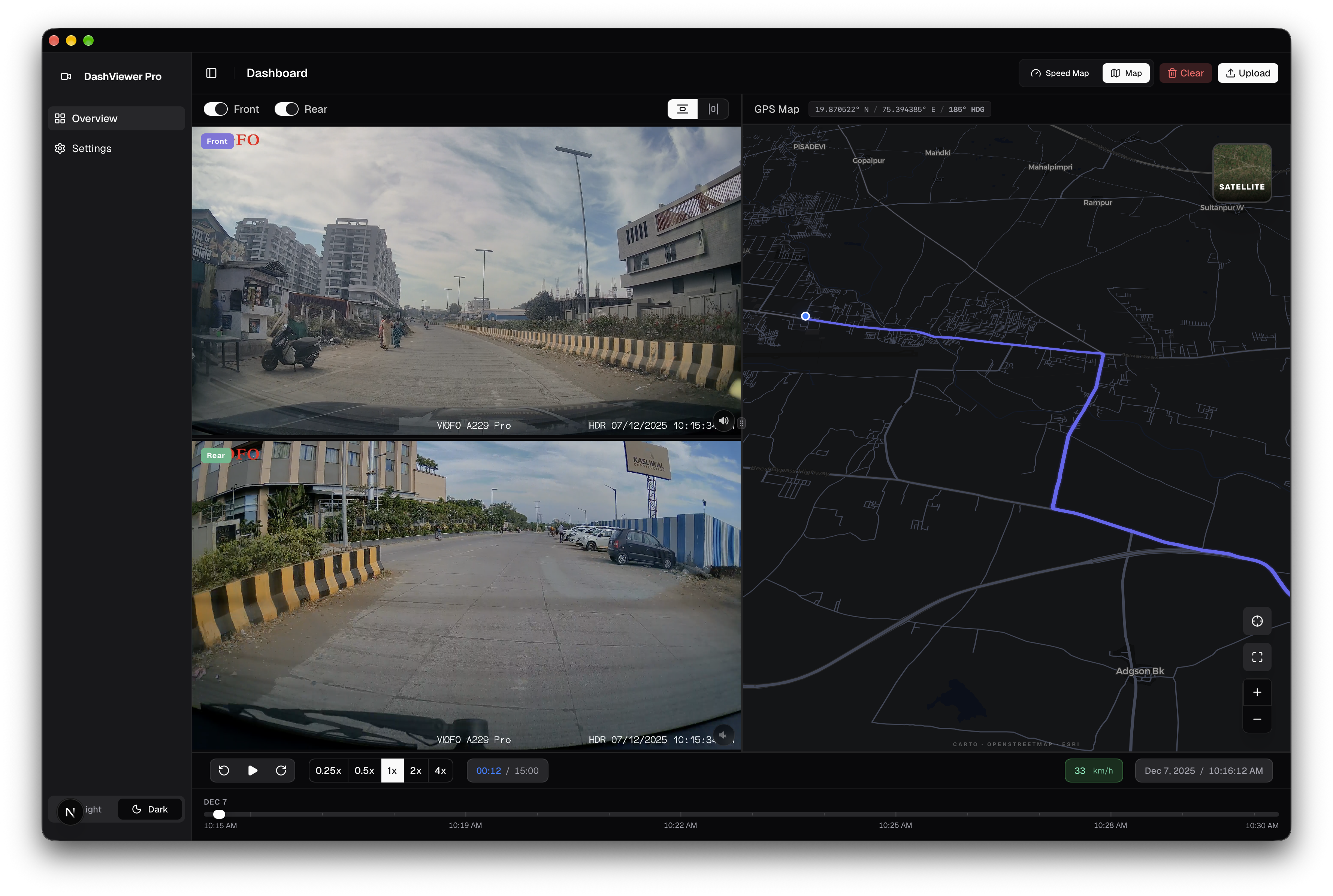
01 / UNIFIED VIEW
Multi-Pane Dashboard
Correlates video playback with real-time GPS coordinate plotting and vehicle telemetry gauges in a unified cockpit.
- Master video clock driving real-time map and speedometer updates
- Interactive timeline scrubbing synchronized across all panels
- Dual-camera support sharing a single telemetry timeline
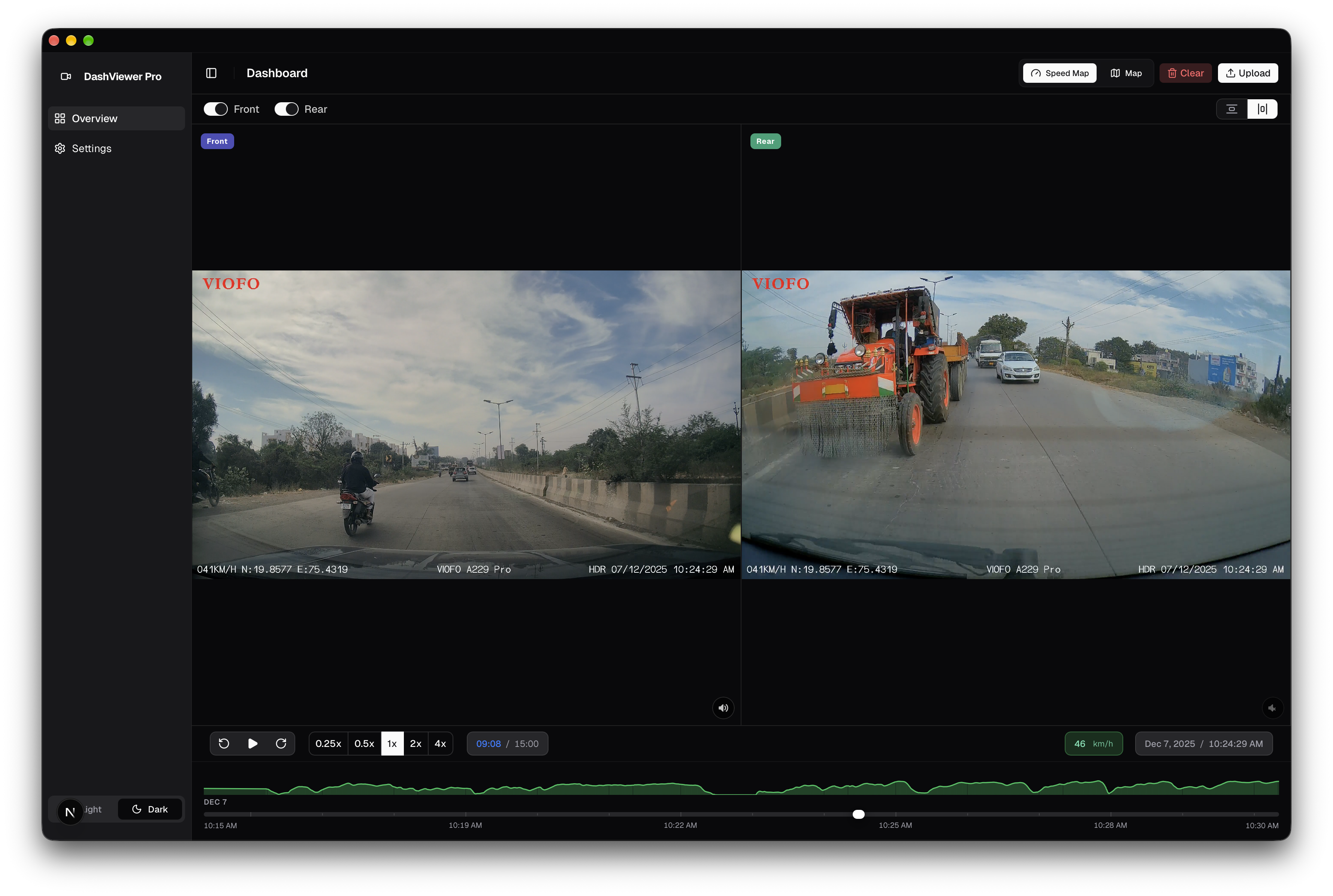
02 / VIDEO FOCUS
Focused Dashcam Theater Mode
Full-screen video workspace for detailed frame inspection and incident analysis.
- Distraction-free high-resolution video frame for incident scrutiny
- Variable playback rates (0.5x to 4.0x) with zero pitch distortion
- Low-latency keyboard seek shortcuts for frame-by-frame navigation
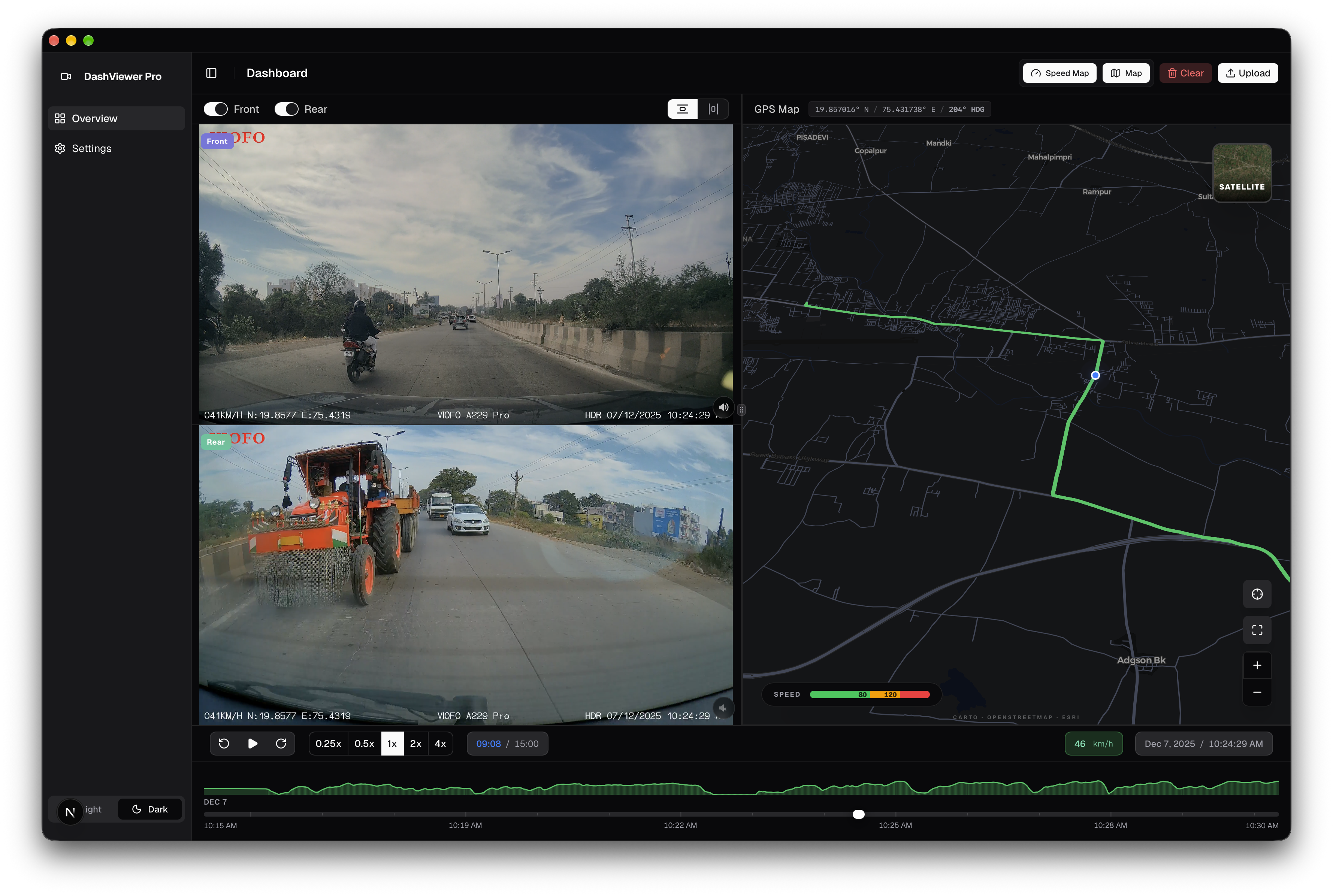
03 / GEOSPATIAL
Speed & Route Heatmap
Interactive geospatial visualization of vehicle telemetry with velocity-based route gradients.
- Continuous velocity color spectrum (green to red) highlighting speed thresholds
- Hardware-accelerated HTML5 Canvas handling 10,000+ telemetry coordinates
- Direct click-on-route seeking to jump the video to any geospatial point
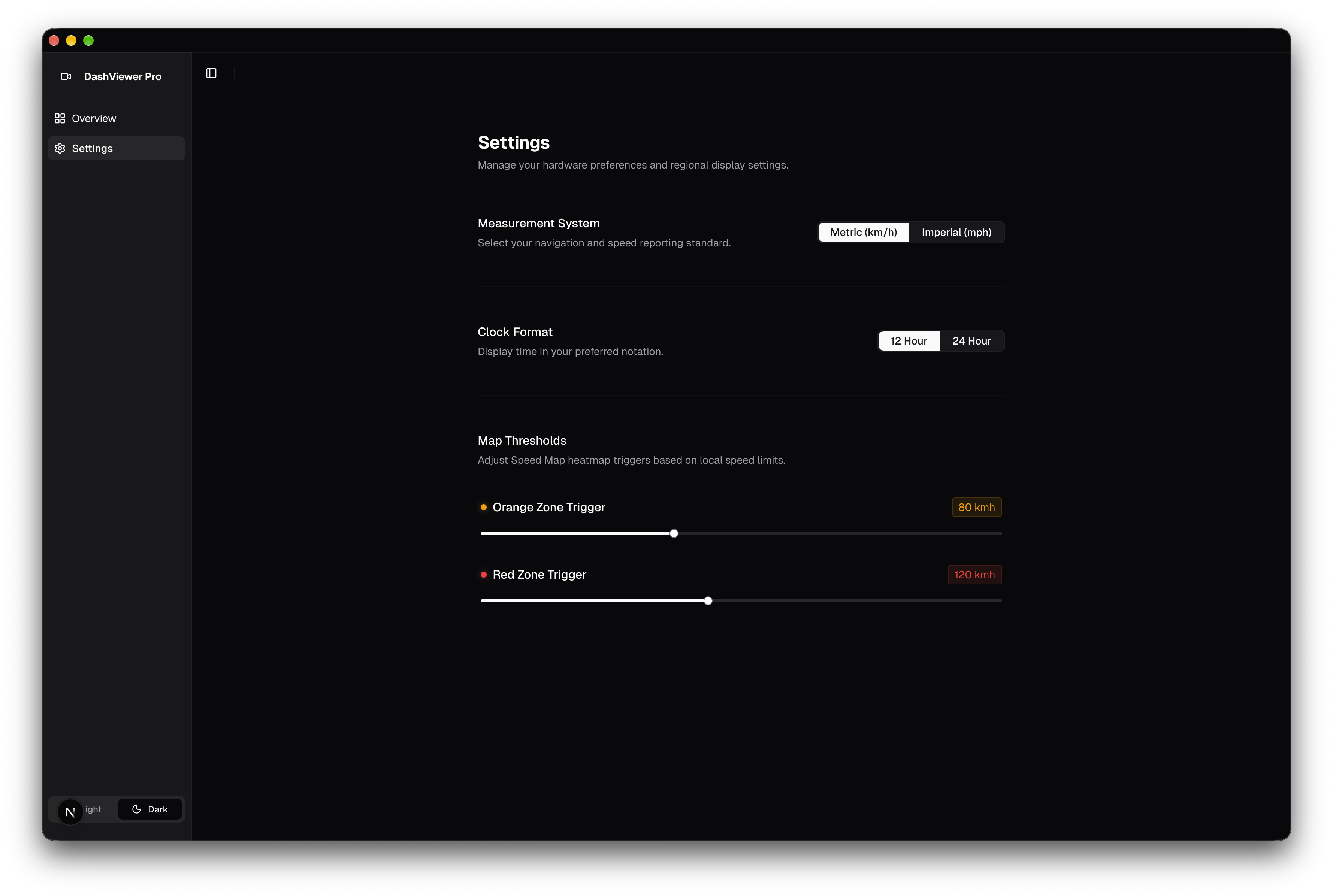
04 / CALIBRATION
Settings & Sensor Calibration
Configuration interface for fine-tuning sensor latency offsets, unit preferences, and dataset exporting.
- Millisecond timestamp offset calibration between video and GPS sensors
- Dynamic toggle between metric (km/h) and imperial (mph) units
- Built-in telemetry export for GPX, NMEA, and CSV formats
⚡ Engineering Challenges
01 / TIME SYNCHRONIZATION
Multi-Rate Time Synchronization Engine
- Challenge: Dashcam video frames run at 30/60 FPS, while embedded GPS loggers sample at variable rates (typically 1Hz to 10Hz) and accelerometer/gyro sensors stream at 50Hz+. Direct index matching leads to drift and desynchronization during seeking.
- Solution: Engineered a unified timeline abstraction using linear interpolation (LERP) and binary search across monotonic epoch timestamps. The video playback clock serves as the master time source, dispatching high-frequency tick events to synchronize all geospatial and sensor layers.
02 / REAL-TIME CANVAS
Real-Time Canvas Speed Heatmap
- Challenge: Rendering hundreds of thousands of telemetry data points in DOM elements or standard SVG graphs causes severe frame drops during high-speed scrubbing.
- Solution: Developed a custom HTML5 Canvas rendering pipeline with offscreen buffering. The speed profile is colored dynamically using a multi-stop gradient (green → yellow → red) based on velocity thresholds, rendering over 60 FPS even during fast-forward (4x) playback.
03 / GEOSPATIAL PROJECTION
Geospatial Route Projection
- Challenge: Accurately mapping vehicle movement without lagging behind high-speed video or causing map tile re-render thrashing.
- Solution: Implemented a smoothed bounding-box viewport follower that batches map coordinate updates, updating the vehicle marker position continuously while debouncing full map camera recalculations.